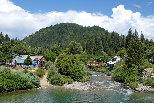
Information about the Yuba River of California.
Course of the Yuba River
-
North Yuba River4 North Fork of the Yuba River
----- Main tributary of the Yuba River
----- About 60 miles long
----- New Bullards Bar Reservoir
----- New Bullards Bar Dam
----- Tributary: Downie River
----- Tributary: Goodyears Creek
----- Tributary: Canyon Creek
----- Tributary: Slate Creek
-
Middle Yuba River / Middle Fork of the Yuba River
----- Begins just south of New Bullards Bar Dam
-
South Yuba River / South Fork of the Yuba River
----- Aout 65 miles long
----- Lake Angela Dam
----- Lake Van Noirden Dam
----- Lake Spaulding Dam
-
Main Stem of the Yuba Rivern(aka middle fork?)
Wild and Scenic South Yuba River
Friends of the River: North Yuba River
Yuba River Scenic Byway
- 160 mile scenic loop
- From Nevada City, drive north on Highway 49
- Cross south and middle forks of the Yuba River
- Historic towns of North San Juan and Camptonville
- Downieville
- Follow North Yubaq River to Sierra City
- Pass Sierra Buttes
- Cross the Yuba Pass
- Meadows of the Sierra Valley
- South on Highway 89 to Truckee
- West to Donner lake on Old U.S. 40
- Interstate 80
- State Scenic Route 20 to Nevada City
GOLD RUSH TOWNS:
- Nevada City
- North San Juan
- Camptonville
- Downieville
- Sierra City
- Bassetts Station
- Sierraville
- Truckee
ATTRACTIONS:
- Empire Minbe State Historic Park
- South Yuba River State Park
- Malakoff Diggins State Historic Park
- Donner Memorial State Park
- Three forks of the Yuba River
- Sierra Buttes Lakes Basin Recreation Area
- Donner Lake
- Donner Summit
South Yuba River State Park
South Yuba River Park Association
South Yuba River Swimming Hole (Video)
Lodging
Yuba River Inn Cabins
South Yuba Trail and Campground/span>
Other Resources
Wikipedia Introduction to the Yuba River
South Yuba River Citizens League
Other Rivers in California
Bodies of Water in California
Visitor Attractions in California
Northern California Travel Guide


